|
search place name
|
||
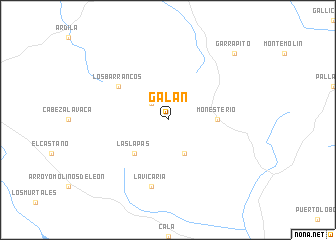
Galán (Extremadura, Spain)Galán is a town in the Extremadura region of Spain. An overview map of the region around Galán is displayed below.
regional and 3d topo map of Galán, Spain ::
Galán airports ::
The nearest airport is SVQ - Sevilla, located 82.7 km south east of Galán.
Other airports nearby include BJZ - Badajoz Talavera La Real (99.9 km north west), OZP - Sevilla Moron Ab (118.3 km south east), ODB - Cordoba (131.7 km east), XRY - Jerez (150.3 km south), Nearby towns ::
Calera de León (2.4km north west) //
Arroyo del Moro y Los Cotos (4.0km south) //
Las Lapas (4.7km south west) //
Monesterio (4.4km east) //
Los Barrancos (5.7km north west) //
La Vicaría (7.6km south) //
Garrapito (9.4km north east) //
[all distances 'as the bird flies' and approximate] 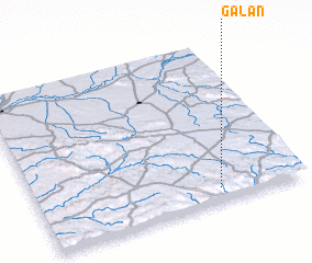 Places with similar names to Galán, Spain ::
Disclaimer :: Information on this page comes without warranty of any kind |
||
|
Where is Galán? Elevation and coordinates ::
Latitude (lat): 38°5'0"N Longitude (lon): 6°19'0"W
Elevation (approx.): 710m (map arrows pan, magnifying glasses zoom) |
||
|
Visiting Galán? Hotel/Accommodation ::
Book a hotel in Galán Travel Guide ::
Buy a travel guide for Spain rental cars ::
car rental offers GPS waypoint ::
download a GPX waypoint (PoI) of Galán for your GPS receiver
|
||