|
search place name
|
||
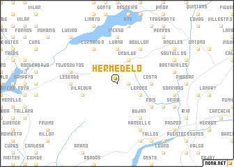
Hermedelo (Galicia, Spain)Hermedelo is a town in the Galicia region of Spain. An overview map of the region around Hermedelo is displayed below.
regional and 3d topo map of Hermedelo, Spain ::
Hermedelo airports ::
The nearest airport is SCQ - Santiago, located 29.4 km east of Hermedelo.
Other airports nearby include LCG - La Coruna A Coruna (63.5 km north east), VGO - Vigo (63.9 km south), OPO - Porto (172.5 km south), VRL - Vila Real (189.7 km south east), Nearby towns ::
Aguasantas (1.4km east) //
Leroño (3.3km south east) //
Urdilde (3.9km north) //
Calle (3.9km north) //
Costa (4.1km east) //
Luaña (5.6km north) //
Vilacova (4.5km south west) //
Herbogo (5.5km south east) //
Dices (5.5km south east) //
Buján (6.2km south east) //
Rois (5.5km south east) //
Boullón (6.2km north east) //
Cornanda (6.2km north west) //
Lesende (5.4km west) //
Viceso (7.4km north) //
Tojos Outos (5.7km west) //
Oín (6.6km south east) //
Manselle (7.9km south) //
Laiño (7.9km south) //
Perros (9.2km north east) //
Brion (9.2km north east) //
Lueiro (9.2km north west) //
[all distances 'as the bird flies' and approximate]  Places with similar names to Hermedelo, Spain ::
Disclaimer :: Information on this page comes without warranty of any kind |
||
|
Where is Hermedelo? Elevation and coordinates ::
Latitude (lat): 42°48'0"N Longitude (lon): 8°45'0"W
Elevation (approx.): 381m (map arrows pan, magnifying glasses zoom) |
||
|
Visiting Hermedelo? Hotel/Accommodation ::
Book a hotel in Hermedelo Travel Guide ::
Buy a travel guide for Spain rental cars ::
car rental offers GPS waypoint ::
download a GPX waypoint (PoI) of Hermedelo for your GPS receiver
|
||