|
search place name
|
||
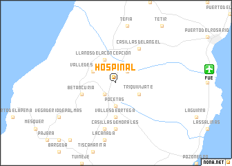
Hospinal (Canarias, Spain)Hospinal is a town in the Canarias region of Spain. An overview map of the region around Hospinal is displayed below.
regional and 3d topo map of Hospinal, Spain ::
Hospinal airports ::
The nearest airport is FUE - Fuerteventura, located 13.5 km east of Hospinal.
Other airports nearby include ACE - Lanzerote Lanzarote (68.6 km north east), LPA - Gran Canaria (147.1 km west), Nearby towns ::
Antigua (2.5km south west) //
La Ampuyenta (2.5km north east) //
Pocetas (3.7km south) //
Triquivijate (3.7km south east) //
Valle de Santa Inés (3.7km north west) //
Llanos de la Concepción (4.0km north west) //
Valles de Ortega (5.6km south) //
Betancuría (5.2km west) //
Casillas del Ángel (6.4km north east) //
Casillas de Morales (7.4km south) //
Agua de Bueyes (7.6km south) //
[all distances 'as the bird flies' and approximate] 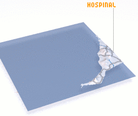 Places with similar names to Hospinal, Spain :: Disclaimer :: Information on this page comes without warranty of any kind |
||
|
Where is Hospinal? Elevation and coordinates ::
Latitude (lat): 28°26'0"N Longitude (lon): 14°0'0"W
Elevation (approx.): 316m (map arrows pan, magnifying glasses zoom) |
||
|
Visiting Hospinal? Hotel/Accommodation ::
Book a hotel in Hospinal Travel Guide ::
Buy a travel guide for Spain rental cars ::
car rental offers GPS waypoint ::
download a GPX waypoint (PoI) of Hospinal for your GPS receiver
|
||