|
search place name
|
||
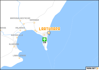
La Atunara (Andalucía, Spain)La Atunara is a town in the Andalucía region of Spain. An overview map of the region around La Atunara is displayed below.
regional and 3d topo map of La Atunara, Spain ::
La Atunara airports ::
The nearest airport is GIB - Gibraltar, located 2.3 km south west of La Atunara.
Other airports nearby include TTU - Tetouan Saniat Rmel (63.5 km south), TNG - Tanger Ibn Batouta (71.8 km south west), XRY - Jerez (91.4 km north west), AGP - Malaga (93.7 km north east), Nearby towns ::
La Línea de la Concepción (1.7km west) //
El Campamento (4.3km west) //
Puente Mayorga (4.9km west) //
San Roque (6.7km north west) //
[all distances 'as the bird flies' and approximate]  Places with similar names to La Atunara, Spain ::
// Leitner (US)
// La Tenería (CU)
// Latanier (US)
// Ladner (US)
// La Tenería (GT)
// Latonro (ID)
// La Tenería (MX)
// La Tenería (MX)
// Latanier (HT)
// Latanier (HT)
Disclaimer :: Information on this page comes without warranty of any kind |
||
|
Where is La Atunara? Elevation and coordinates ::
Latitude (lat): 36°10'0"N Longitude (lon): 5°20'0"W
Elevation (approx.): -32768m (map arrows pan, magnifying glasses zoom) |
||
|
Visiting La Atunara? Hotel/Accommodation ::
Book a hotel in La Atunara Travel Guide ::
Buy a travel guide for Spain rental cars ::
car rental offers GPS waypoint ::
download a GPX waypoint (PoI) of La Atunara for your GPS receiver
|
||