|
search place name
|
||
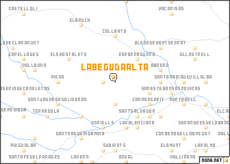
La Beguda Alta (Cataluña, Spain)La Beguda Alta is a town in the Cataluña region of Spain. An overview map of the region around La Beguda Alta is displayed below.
regional and 3d topo map of La Beguda Alta, Spain ::
La Beguda Alta airports ::
The nearest airport is BCN - Barcelona, located 30.5 km south east of La Beguda Alta.
Other airports nearby include REU - Reus (68.1 km south west), GRO - Gerona Girona (89.1 km north east), LEU - Seo De Urgel (99.6 km north), PGF - Perpignan Rivesaltes (162.3 km north east), Nearby towns ::
Masquefa (1.4km west) //
San Lorenzo de Hortóns (3.7km south) //
Esparraguera (4.6km north east) //
Caʼn Prats (4.6km south east) //
Caʼn Margarit (5.6km south east) //
Sant Salvador (6.2km south east) //
Collbató (7.4km north) //
Las Matas (5.6km east) //
Espiells (7.5km south) //
El Puig (7.5km south) //
Abrera (5.9km east) //
El Rebato (5.9km east) //
Caʼn Bargalló (6.9km south east) //
Monistrol de Noya (6.9km south west) //
Els Hostalets (6.7km north west) //
La Valenciana (7.9km south) //
Els Taronjers (7.9km south) //
Gélida (7.9km south) //
Castellví de Rosanés (7.9km south east) //
Olesa de Montserrat (7.9km north east) //
[all distances 'as the bird flies' and approximate] 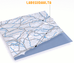 Places with similar names to La Beguda Alta, Spain :: Disclaimer :: Information on this page comes without warranty of any kind |
||
|
Where is La Beguda Alta? Elevation and coordinates ::
Latitude (lat): 41°30'0"N Longitude (lon): 1°50'0"E
Elevation (approx.): 290m (map arrows pan, magnifying glasses zoom) |
||
|
Visiting La Beguda Alta? Hotel/Accommodation ::
Book a hotel in La Beguda Alta Travel Guide ::
Buy a travel guide for Spain rental cars ::
car rental offers GPS waypoint ::
download a GPX waypoint (PoI) of La Beguda Alta for your GPS receiver
|
||