|
search place name
|
||
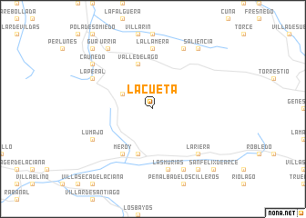
La Cueta (Castilla y León, Spain)La Cueta is a town in the Castilla y León region of Spain. An overview map of the region around La Cueta is displayed below.
regional and 3d topo map of La Cueta, Spain ::
La Cueta airports ::
The nearest airport is OVD - Aviles Asturias, located 61.9 km north of La Cueta.
Other airports nearby include BGC - Braganca (135.8 km south), VLL - Valladolid (182.3 km south east), VRL - Vila Real (231.5 km south west), Nearby towns ::
El Puerto de Somiedo (3.3km north west) //
Valle de Lago (5.7km north) //
La Vega de los Viejos (5.7km south) //
Meroy (6.2km south west) //
La Llamera (7.4km north) //
Las Murias (7.5km south) //
La Riera (6.9km south east) //
Éndriga (7.9km north) //
La Peral (6.6km north west) //
Cabrillanes (7.9km south) //
Lumajo (6.6km south west) //
Coto de Buenamadre (8.5km north west) //
Saliencia (8.5km north east) //
Urria (8.5km north west) //
Caunedo (7.8km north west) //
Mena (8.5km south east) //
Gúa (9.2km north west) //
San Félix de Arce (9.2km south east) //
[all distances 'as the bird flies' and approximate] 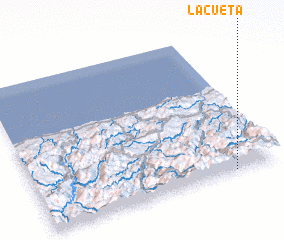 Places with similar names to La Cueta, Spain ::
Disclaimer :: Information on this page comes without warranty of any kind |
||
|
Where is La Cueta? Elevation and coordinates ::
Latitude (lat): 43°1'0"N Longitude (lon): 6°11'0"W
Elevation (approx.): 1486m (map arrows pan, magnifying glasses zoom) |
||
|
Visiting La Cueta? Hotel/Accommodation ::
Book a hotel in La Cueta Travel Guide ::
Buy a travel guide for Spain rental cars ::
car rental offers GPS waypoint ::
download a GPX waypoint (PoI) of La Cueta for your GPS receiver
|
||