|
search place name
|
||
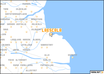
La Escala (Cataluña, Spain)La Escala is a town in the Cataluña region of Spain. An overview map of the region around La Escala is displayed below.
regional and 3d topo map of La Escala, Spain ::
La Escala airports ::
The nearest airport is GRO - Gerona Girona, located 39.1 km south west of La Escala.
Other airports nearby include PGF - Perpignan Rivesaltes (72.6 km north), BCN - Barcelona (126.5 km south west), BZR - Beziers Vias (135.3 km north), CCF - Carcassonne Salvaza (139.7 km north west), Nearby towns ::
Ampurias (2.3km north west) //
Sobrestany (4.0km south) //
Bellcaire dʼEmpordà (4.6km south west) //
Vilademat (4.5km north west) //
Albóns (4.5km south west) //
Pelacals (5.5km north west) //
Ullá (7.5km south) //
Armentera (6.9km north west) //
Montiró (6.6km north west) //
San Pedro Pescador (8.5km north west) //
Saldet (7.8km north west) //
Estartit (9.2km south east) //
[all distances 'as the bird flies' and approximate]  Places with similar names to La Escala, Spain ::
// Liscol (PH)
// Los Sigola (PA)
// La Scala (IT)
// Lossiküla (EE)
// La Acequilla (ES)
// La Escuela (CO)
// La Socola (CO)
// La Escuela (MX)
// Lusikili (NA)
// LʼEscale (FR)
Disclaimer :: Information on this page comes without warranty of any kind |
||
|
Where is La Escala? Elevation and coordinates ::
Latitude (lat): 42°7'0"N Longitude (lon): 3°8'0"E
Elevation (approx.): 17m (map arrows pan, magnifying glasses zoom) |
||
|
Visiting La Escala? Hotel/Accommodation ::
Book a hotel in La Escala Travel Guide ::
Buy a travel guide for Spain rental cars ::
car rental offers GPS waypoint ::
download a GPX waypoint (PoI) of La Escala for your GPS receiver
|
||