|
search place name
|
||
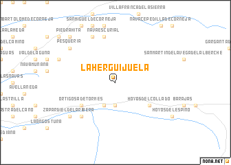
La Herguijuela (Castilla y León, Spain)La Herguijuela is a town in the Castilla y León region of Spain. An overview map of the region around La Herguijuela is displayed below.
regional and 3d topo map of La Herguijuela, Spain ::
La Herguijuela airports ::
The nearest airport is SLM - Salamanca, located 64.9 km north of La Herguijuela.
Other airports nearby include MAD - Madrid Barajas (143.2 km east), VLL - Valladolid (148.9 km north), TOJ - Madrid Torrejon (153.4 km east), BGC - Braganca (202.9 km north west), Nearby towns ::
Navacepeda de Tormes (3.7km south) //
San Bartolomé de Tormes (4.0km south) //
Hoyos del Collado (5.6km south east) //
Ortigosa de Tormes (5.6km south west) //
Navaescurial (7.5km north) //
Navalperal de Tormes (7.0km south west) //
Las Marías (7.9km north) //
Zapardiel de la Ribera (7.9km south west) //
Pesquería (7.9km north west) //
La Cañada (7.9km north west) //
Piedrahita (9.3km north west) //
[all distances 'as the bird flies' and approximate] 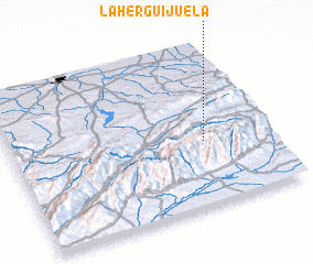 Places with similar names to La Herguijuela, Spain :: Disclaimer :: Information on this page comes without warranty of any kind |
||
|
Where is La Herguijuela? Elevation and coordinates ::
Latitude (lat): 40°24'0"N Longitude (lon): 5°15'0"W
Elevation (approx.): 1605m (map arrows pan, magnifying glasses zoom) |
||
|
Visiting La Herguijuela? Hotel/Accommodation ::
Book a hotel in La Herguijuela Travel Guide ::
Buy a travel guide for Spain rental cars ::
car rental offers GPS waypoint ::
download a GPX waypoint (PoI) of La Herguijuela for your GPS receiver
|
||