|
search place name
|
||
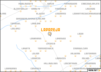
La Pareja (Murcia, Spain)La Pareja is a town in the Murcia region of Spain. An overview map of the region around La Pareja is displayed below.
regional and 3d topo map of La Pareja, Spain ::
La Pareja airports ::
The nearest airport is MJV - Murcia San Javier, located 29.4 km south east of La Pareja.
Other airports nearby include ALC - Alicante (66.0 km north east), LEI - Almeria (160.1 km south west), VLC - Valencia (186.6 km north), Nearby towns ::
Los Baños (2.4km south west) //
Venta de la Virgen (2.4km south west) //
Caserío Los Tarquinos (2.4km south east) //
La Tercia (3.7km south) //
Lo Mendigo (3.5km south east) //
Fuensanta (5.6km north) //
Santo Ángel (5.6km north) //
Torre-Mochuela (5.7km south) //
Los Brianes (4.8km south west) //
La Alberca (5.7km north) //
Verdolay (5.7km north) //
Corvera (6.3km south west) //
El Palmar (6.3km north west) //
Cuevas del Cigarrón (5.7km north west) //
La Paloma (5.7km north west) //
El Caracolero (5.9km east) //
Casas del Civil (6.1km east) //
Algezares (7.6km north) //
Aljucer (8.0km north) //
Los Garres (8.0km north) //
Los Martínez (8.6km south east) //
Lo León (8.6km south west) //
Casas de los Garcías (8.1km south west) //
[all distances 'as the bird flies' and approximate]  Places with similar names to La Pareja, Spain ::
Disclaimer :: Information on this page comes without warranty of any kind |
||
|
Where is La Pareja? Elevation and coordinates ::
Latitude (lat): 37°53'0"N Longitude (lon): 1°7'0"W
Elevation (approx.): 305m (map arrows pan, magnifying glasses zoom) |
||
|
Visiting La Pareja? Hotel/Accommodation ::
Book a hotel in La Pareja Travel Guide ::
Buy a travel guide for Spain rental cars ::
car rental offers GPS waypoint ::
download a GPX waypoint (PoI) of La Pareja for your GPS receiver
|
||