|
search place name
|
||
Las Tejeras (Asturias, Spain)Las Tejeras is a town in the Asturias region of Spain. An overview map of the region around Las Tejeras is displayed below.
regional and 3d topo map of Las Tejeras, Spain ::

Las Tejeras airports ::
The nearest airport is OVD - Aviles Asturias, located 42.2 km north of Las Tejeras.
Other airports nearby include BGC - Braganca (163.7 km south west), VLL - Valladolid (186.4 km south east), VRL - Vila Real (262.2 km south west), Nearby towns ::
Llamo (0.0km north) //
San Adriano (0.0km north) //
Ríoseco (1.9km south) //
Muriellos (3.7km north) //
Muñón Cimero (2.7km east) //
Doña Juandi (3.9km north) //
El Cabornín (3.9km north) //
La Muela (3.3km south east) //
La Juncar (4.6km north east) //
Maramuñiz (4.6km south east) //
Otura (5.6km north) //
Lugar de Abajo (5.7km north) //
Lugar de Arriba (5.7km north) //
Armada (5.7km south) //
Porcío (5.7km north) //
Villaestremerí (4.5km north east) //
Muriellos (5.5km south west) //
Muñón Fondero (5.5km south east) //
Piedraceda (6.2km south east) //
Grandiella (6.2km north west) //
Llanuces (6.2km south west) //
Retrullés (5.4km east) //
Tablado (7.4km south) //
Villar de Gallegos (5.7km east) //
Canga de Abajo (5.7km east) //
Cenera (5.7km east) //
La Vega (5.7km east) //
San Martino (5.7km east) //
Villallana (5.7km east) //
[all distances 'as the bird flies' and approximate] 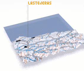 Places with similar names to Las Tejeras, Spain ::
// Las Tijeras (MX)
// Las Tijeras (MX)
// Las Tejeras (HN)
// Las Tejerias (VE)
// Las Tejerías (VE)
// Las Tejerías (VE)
Disclaimer :: Information on this page comes without warranty of any kind |
||
|
Where is Las Tejeras? Elevation and coordinates ::
Latitude (lat): 43°12'0"N Longitude (lon): 5°53'0"W
Elevation (approx.): 450m (map arrows pan, magnifying glasses zoom) |
||
|
Visiting Las Tejeras? Hotel/Accommodation ::
Book a hotel in Las Tejeras Travel Guide ::
Buy a travel guide for Spain rental cars ::
car rental offers GPS waypoint ::
download a GPX waypoint (PoI) of Las Tejeras for your GPS receiver
|
||