|
search place name
|
||
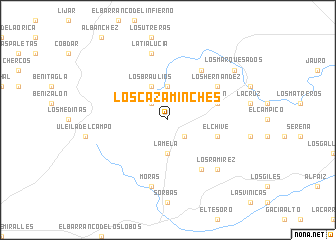
Los Cazaminches (Andalucía, Spain)Los Cazaminches is a town in the Andalucía region of Spain. An overview map of the region around Los Cazaminches is displayed below.
regional and 3d topo map of Los Cazaminches, Spain ::
Los Cazaminches airports ::
The nearest airport is LEI - Almeria, located 45.5 km south west of Los Cazaminches.
Other airports nearby include MJV - Murcia San Javier (131.8 km north east), GRX - Granada Armilla (135.1 km west), GRX - Granada (147.4 km west), ALC - Alicante (182.5 km north east), Nearby towns ::
Los Jarales (2.4km north west) //
El Pilar y Provincias (2.4km south east) //
La Breña (3.7km north) //
La Mela (3.7km south) //
El Fonte (3.7km south) //
Los Braulios (4.0km north) //
Lubrín (4.8km north east) //
El Chive (4.8km south east) //
Los Hernández (5.8km north east) //
La Yedra (6.3km north east) //
Los Maños (6.3km south east) //
Los Alias (6.3km south east) //
La Tía Lucía (7.6km north) //
Moras (7.6km south) //
Los Ramírez (7.1km south east) //
Los Pérez (7.1km south east) //
Los Marquesados (8.1km north east) //
[all distances 'as the bird flies' and approximate] 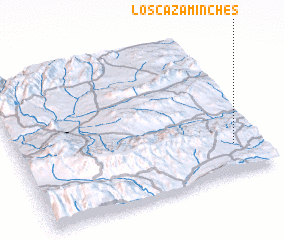 Places with similar names to Los Cazaminches, Spain :: Disclaimer :: Information on this page comes without warranty of any kind |
||
|
Where is Los Cazaminches? Elevation and coordinates ::
Latitude (lat): 37°12'0"N Longitude (lon): 2°7'0"W
Elevation (approx.): 648m (map arrows pan, magnifying glasses zoom) |
||
|
Visiting Los Cazaminches? Hotel/Accommodation ::
Book a hotel in Los Cazaminches Travel Guide ::
Buy a travel guide for Spain rental cars ::
car rental offers GPS waypoint ::
download a GPX waypoint (PoI) of Los Cazaminches for your GPS receiver
|
||