|
search place name
|
||
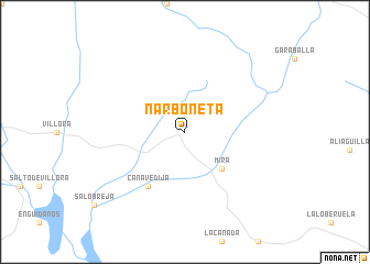
Narboneta (Castilla-La Mancha, Spain)Narboneta is a town in the Castilla-La Mancha region of Spain. An overview map of the region around Narboneta is displayed below.
regional and 3d topo map of Narboneta, Spain ::
Narboneta airports ::
The nearest airport is VLC - Valencia, located 89.4 km east of Narboneta.
Other airports nearby include ALC - Alicante (181.0 km south east), TOJ - Madrid Torrejon (188.0 km north west), ZAZ - Zaragoza Ab (215.8 km north), MJV - Murcia San Javier (226.5 km south), Nearby towns ::
Mira (4.7km south east) //
Cañavedija (6.2km south west) //
[all distances 'as the bird flies' and approximate]  Places with similar names to Narboneta, Spain ::
// Narāy Band (IR)
// Nārband (IR)
// Nareh Band (IR)
// Nairai Bānda (PK)
// Narai Bānda (PK)
// Niār Bānda (PK)
// Nuro Bānda (PK)
// Narai Bānda (PK)
// Nūro Bānda (PK)
Disclaimer :: Information on this page comes without warranty of any kind |
||
|
Where is Narboneta? Elevation and coordinates ::
Latitude (lat): 39°45'0"N Longitude (lon): 1°28'0"W
Elevation (approx.): 871m (map arrows pan, magnifying glasses zoom) |
||
|
Visiting Narboneta? Hotel/Accommodation ::
Book a hotel in Narboneta Travel Guide ::
Buy a travel guide for Spain rental cars ::
car rental offers GPS waypoint ::
download a GPX waypoint (PoI) of Narboneta for your GPS receiver
|
||