|
search place name
|
||
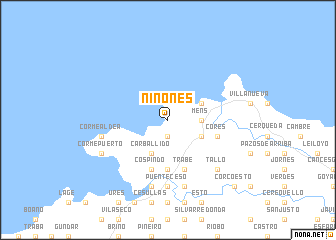
Niñonés (Galicia, Spain)Niñonés is a town in the Galicia region of Spain. An overview map of the region around Niñonés is displayed below.
regional and 3d topo map of Niñonés, Spain ::
Niñonés airports ::
The nearest airport is LCG - La Coruna A Coruna, located 42.4 km east of Niñonés.
Other airports nearby include SCQ - Santiago (59.7 km south east), VGO - Vigo (120.8 km south), Nearby towns ::
Brantuas (1.9km south) //
Mens (2.7km east) //
Asalo (2.7km east) //
Carballido (3.9km south) //
Campara (3.3km south east) //
Barizo (3.3km north east) //
Lestimoño (5.6km south) //
Trabe (5.7km south) //
Cospindo (5.7km south) //
Graña (5.7km south) //
Tella (5.7km south) //
Cores (4.5km south east) //
Puente-Ceso (7.4km south) //
Corme-Aldea (5.7km west) //
Allones (7.5km south) //
Neaño (7.5km south) //
Tallo (6.9km south east) //
Corme-Puerto (6.5km south west) //
Corcoesto (9.2km south east) //
[all distances 'as the bird flies' and approximate] 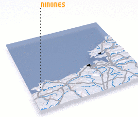
Disclaimer :: Information on this page comes without warranty of any kind |
||
|
Where is Niñonés? Elevation and coordinates ::
Latitude (lat): 43°18'0"N Longitude (lon): 8°54'0"W
Elevation (approx.): 99m (map arrows pan, magnifying glasses zoom) |
||
|
Visiting Niñonés? Hotel/Accommodation ::
Book a hotel in Niñonés Travel Guide ::
Buy a travel guide for Spain rental cars ::
car rental offers GPS waypoint ::
download a GPX waypoint (PoI) of Niñonés for your GPS receiver
|
||