|
search place name
|
||
Oma (País Vasco, Spain)Oma is a town in the País Vasco region of Spain. An overview map of the region around Oma is displayed below.
regional and 3d topo map of Oma, Spain ::

Oma airports ::
The nearest airport is BIO - Bilbao, located 24.1 km west of Oma.
Other airports nearby include VIT - Vitoria (50.8 km south), EAS - San Sebastian (67.0 km east), BIQ - Biarritz-bayonne Anglet (89.8 km east), SDR - Santander (98.1 km west), Nearby towns ::
Icazurietas (1.3km east) //
Gavica (1.3km east) //
Ceas (1.9km north) //
Bollar (1.9km north) //
Elejalde (1.9km north) //
Gorocica (2.3km south west) //
Barroeta (2.3km south west) //
Zabala (2.3km south west) //
Basondo (2.3km north west) //
Acorda (2.3km north east) //
Cortézubi (2.7km west) //
Terleguiz (2.7km west) //
Inchaurragas (2.7km east) //
Basecheas (3.7km north) //
Zubiate (3.3km south west) //
Celayeta (3.3km north west) //
Navárniz-Elejalde (3.3km south east) //
Merica (3.3km south east) //
Zabaleta (3.3km south east) //
Uribarri (3.3km south east) //
Lequerica (3.3km south east) //
Basechetas (3.9km north) //
Olagorta (3.9km north) //
Marmiz (4.6km south west) //
Ibarrola (4.6km south east) //
Olabe (4.6km north east) //
Allona (4.6km north east) //
Nachitua (5.6km north) //
Arbóliz (5.6km north) //
[all distances 'as the bird flies' and approximate] 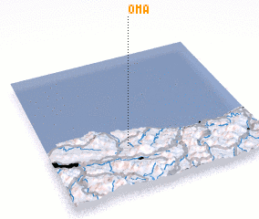 Places with similar names to Oma, Spain ::
Disclaimer :: Information on this page comes without warranty of any kind |
||
|
Where is Oma? Elevation and coordinates ::
Latitude (lat): 43°20'0"N Longitude (lon): 2°37'0"W
Elevation (approx.): 114m (map arrows pan, magnifying glasses zoom) |
||
|
Visiting Oma? Hotel/Accommodation ::
Book a hotel in Oma Travel Guide ::
Buy a travel guide for Spain rental cars ::
car rental offers GPS waypoint ::
download a GPX waypoint (PoI) of Oma for your GPS receiver
|
||