|
search place name
|
||
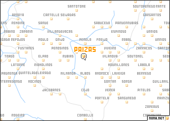
Paizás (Galicia, Spain)Paizás is a town in the Galicia region of Spain. An overview map of the region around Paizás is displayed below.
regional and 3d topo map of Paizás, Spain ::
Paizás airports ::
The nearest airport is VGO - Vigo, located 52.3 km west of Paizás.
Other airports nearby include SCQ - Santiago (87.9 km north west), VRL - Vila Real (101.8 km south), BGC - Braganca (112.5 km east), OPO - Porto (116.7 km south west), Nearby towns ::
Freá de Eiras (2.3km north west) //
Mosteiro (2.7km west) //
Villameá de Ramiranes (2.7km west) //
Rubiás (2.7km west) //
Penela (3.7km north) //
Anfeoz (3.7km north) //
Albos (3.7km south) //
Casardeita (3.3km north east) //
Celanova (3.3km south east) //
Milmanda (4.0km south) //
Freijo (4.6km north east) //
Amoroce (4.6km south east) //
Milmanda (4.6km south west) //
Vilanova (4.1km east) //
Penosiños (4.1km west) //
Viveiro (4.5km north east) //
Penosiños (4.5km north west) //
Mundil (5.7km north) //
Grijó (5.5km north west) //
Cañón (5.5km south east) //
Cejo (7.4km south) //
Orga (5.5km east) //
Bobadela (5.5km east) //
Coujil (7.5km north) //
Barja (5.8km east) //
Fechas (5.8km east) //
Mourillones (5.8km east) //
La Veiga (5.8km east) //
Gontán (6.9km south east) //
[all distances 'as the bird flies' and approximate] 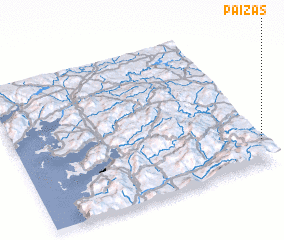 Places with similar names to Paizás, Spain ::
Disclaimer :: Information on this page comes without warranty of any kind |
||
|
Where is Paizás? Elevation and coordinates ::
Latitude (lat): 42°10'0"N Longitude (lon): 8°0'0"W
Elevation (approx.): 611m (map arrows pan, magnifying glasses zoom) |
||
|
Visiting Paizás? Hotel/Accommodation ::
Book a hotel in Paizás Travel Guide ::
Buy a travel guide for Spain rental cars ::
car rental offers GPS waypoint ::
download a GPX waypoint (PoI) of Paizás for your GPS receiver
|
||