|
search place name
|
||
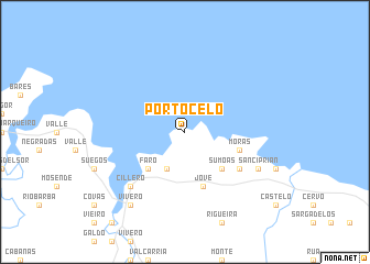
Portocelo (Cataluña, Spain)Portocelo is a town in the Cataluña region of Spain. An overview map of the region around Portocelo is displayed below.
regional and 3d topo map of Portocelo, Spain ::
Portocelo airports ::
The nearest airport is LCG - La Coruna A Coruna, located 83.4 km south west of Portocelo.
Other airports nearby include SCQ - Santiago (117.3 km south west), OVD - Aviles Asturias (122.4 km east), VGO - Vigo (189.1 km south west), BGC - Braganca (219.0 km south), Nearby towns ::
Juances (3.9km south) //
Sumoas (4.6km south east) //
Faro (4.6km south west) //
Jove (5.7km south) //
Morás (4.4km south east) //
Lago (5.5km south east) //
Cillero (6.9km south west) //
San Ciprián (6.5km south east) //
Vivero (8.4km south west) //
[all distances 'as the bird flies' and approximate]  Places with similar names to Portocelo, Spain ::
// Prötzel (DE)
// Porticella (IT)
// Porticello (IT)
// Praticello (IT)
// Portuzelo (PT)
// Portuzelo (PT)
// Portezuelo (ES)
// Praducelo (ES)
// Portezuelo (CL)
// Portezuelo (CL)
Disclaimer :: Information on this page comes without warranty of any kind |
||
|
Where is Portocelo? Elevation and coordinates ::
Latitude (lat): 43°44'0"N Longitude (lon): 7°32'0"W
Elevation (approx.): -32768m (map arrows pan, magnifying glasses zoom) |
||
|
Visiting Portocelo? Hotel/Accommodation ::
Book a hotel in Portocelo Travel Guide ::
Buy a travel guide for Spain rental cars ::
car rental offers GPS waypoint ::
download a GPX waypoint (PoI) of Portocelo for your GPS receiver
|
||