|
search place name
|
||
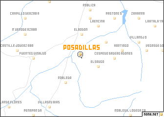
Posadillas (Castilla y León, Spain)Posadillas is a town in the Castilla y León region of Spain. An overview map of the region around Posadillas is displayed below.
regional and 3d topo map of Posadillas, Spain ::
Posadillas airports ::
The nearest airport is SLM - Salamanca, located 106.9 km north east of Posadillas.
Other airports nearby include VRL - Vila Real (134.9 km north west), BGC - Braganca (158.6 km north), BJZ - Badajoz Talavera La Real (172.6 km south), VLL - Valladolid (201.9 km north east), Nearby towns ::
El Saúgo (3.4km south east) //
El Bodón (5.6km north) //
Robleda (6.2km south west) //
Herguijuela de Ciudad Rodrigo (5.6km north east) //
Cespedosa de Agadones (5.6km east) //
La Encina (7.9km north) //
[all distances 'as the bird flies' and approximate]  Places with similar names to Posadillas, Spain ::
// Peustelsau (DE)
// Postolice (PL)
// Pozo Dulce (CU)
// Pištelići (BA)
// Pastales (CO)
// Pozo de Luis (MX)
// Pozo Dulce (VE)
// Puesto Lucy (PY)
// Puesto Luis (PY)
// Počedělice (CZ)
Disclaimer :: Information on this page comes without warranty of any kind |
||
|
Where is Posadillas? Elevation and coordinates ::
Latitude (lat): 40°26'0"N Longitude (lon): 6°34'0"W
Elevation (approx.): 823m (map arrows pan, magnifying glasses zoom) |
||
|
Visiting Posadillas? Hotel/Accommodation ::
Book a hotel in Posadillas Travel Guide ::
Buy a travel guide for Spain rental cars ::
car rental offers GPS waypoint ::
download a GPX waypoint (PoI) of Posadillas for your GPS receiver
|
||