|
search place name
|
||
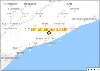
San Ginés de Vilasar (Cataluña, Spain)San Ginés de Vilasar is a town in the Cataluña region of Spain. An overview map of the region around San Ginés de Vilasar is displayed below.
regional and 3d topo map of San Ginés de Vilasar, Spain ::
San Ginés de Vilasar airports ::
The nearest airport is BCN - Barcelona, located 34.3 km south west of San Ginés de Vilasar.
Other airports nearby include GRO - Gerona Girona (53.8 km north east), REU - Reus (108.5 km west), LEU - Seo De Urgel (121.0 km north west), PGF - Perpignan Rivesaltes (142.2 km north), Nearby towns ::
Cabrils (1.9km north) //
San Pedro de Premiá (2.3km south west) //
Cabrera de Mataró (2.8km east) //
Premiá de Mar (3.7km south) //
Agell (3.3km north east) //
Orrius (4.0km north) //
San Juan de Vilasar (3.3km south east) //
Argentona (4.6km north east) //
Vilanova de la Roca (5.6km north west) //
Teyá (5.6km south west) //
Masnou (5.6km south west) //
Vallromanas (5.9km west) //
La Roca (7.9km north) //
Alella (6.7km south west) //
El Carrer del Canonge (6.7km south west) //
Dosríus (8.5km north east) //
Mongat (7.9km south west) //
[all distances 'as the bird flies' and approximate] 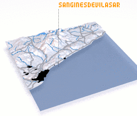 Places with similar names to San Ginés de Vilasar, Spain :: Disclaimer :: Information on this page comes without warranty of any kind |
||
|
Where is San Ginés de Vilasar? Elevation and coordinates ::
Latitude (lat): 41°31'0"N Longitude (lon): 2°22'0"E
Elevation (approx.): 122m (map arrows pan, magnifying glasses zoom) |
||
|
Visiting San Ginés de Vilasar? Hotel/Accommodation ::
Book a hotel in San Ginés de Vilasar Travel Guide ::
Buy a travel guide for Spain rental cars ::
car rental offers GPS waypoint ::
download a GPX waypoint (PoI) of San Ginés de Vilasar for your GPS receiver
|
||