|
search place name
|
||
Tejones (Galicia, Spain)Tejones is a town in the Galicia region of Spain. An overview map of the region around Tejones is displayed below.
regional and 3d topo map of Tejones, Spain ::

Tejones airports ::
The nearest airport is VRL - Vila Real, located 76.9 km south of Tejones.
Other airports nearby include VGO - Vigo (80.8 km west), BGC - Braganca (84.6 km east), OPO - Porto (113.3 km south west), SCQ - Santiago (118.2 km north west), Nearby towns ::
Nocedo (1.9km north) //
Baltar (1.9km south) //
Cobelas (3.7km north) //
Garabelos (2.8km east) //
Guntín (3.3km north west) //
Laroá (4.0km north) //
Blancos (4.6km north west) //
Aguis (4.5km north west) //
Pejeiros (4.5km north west) //
Parada de Riveira (5.7km north) //
Cobas (4.5km south west) //
Niñodaguía (4.5km south east) //
Villamayor de la Boullosa (6.2km south west) //
Seoane (5.6km north east) //
Cima de Ribeira (5.6km north west) //
Damil (7.4km north) //
Moreiras (6.9km north east) //
Mosteiro (6.9km north west) //
Sobreganade (6.9km north west) //
Faramontaos (6.6km north east) //
Chamusiños (7.8km north east) //
Ganade (9.2km north west) //
Abades (9.2km south west) //
Zos (9.2km north east) //
[all distances 'as the bird flies' and approximate] 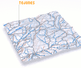 Places with similar names to Tejones, Spain ::
Disclaimer :: Information on this page comes without warranty of any kind |
||
|
Where is Tejones? Elevation and coordinates ::
Latitude (lat): 41°58'0"N Longitude (lon): 7°43'0"W
Elevation (approx.): 855m (map arrows pan, magnifying glasses zoom) |
||
|
Visiting Tejones? Hotel/Accommodation ::
Book a hotel in Tejones Travel Guide ::
Buy a travel guide for Spain rental cars ::
car rental offers GPS waypoint ::
download a GPX waypoint (PoI) of Tejones for your GPS receiver
|
||