|
search place name
|
||
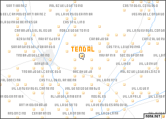
Tendal (Castilla y León, Spain)Tendal is a town in the Castilla y León region of Spain. An overview map of the region around Tendal is displayed below.
regional and 3d topo map of Tendal, Spain ::
Tendal airports ::
The nearest airport is VLL - Valladolid, located 112.8 km south east of Tendal.
Other airports nearby include OVD - Aviles Asturias (115.6 km north), BGC - Braganca (129.3 km south west), SDR - Santander (164.9 km north east), SLM - Salamanca (183.0 km south), Nearby towns ::
Valdefresno (1.4km east) //
Golpejar de la Sobarriba (1.4km west) //
Villavente (1.9km north) //
Corbillos de la Sobarriba (2.3km south west) //
Villaseca de la Sobarriba (2.3km south east) //
Arcahueja (3.7km south) //
Paradilla de la Sobarriba (3.3km south east) //
Villaobispo de las Regueras (3.3km north west) //
Villamoros de las Regueras (3.3km north west) //
Villacil (3.3km north east) //
Valdelafuente (3.9km south) //
Sanfelismo (3.9km south) //
Carbajosa (4.6km north east) //
Villarrodrigo de las Regueras (4.6km north west) //
Villacete (4.6km south east) //
Navafría (4.1km east) //
Robledo de Torío (5.7km north) //
Puente del Castro (4.5km south west) //
Valdesogo de Arriba (5.7km south) //
Toldanos (5.7km south) //
Villalboñe (5.5km north east) //
Valdesogo de Abajo (7.4km south) //
León (5.5km west) //
Villanueva del Árbol (7.5km north) //
Castrillino (7.5km north) //
Canaleja (7.5km north) //
Solanilla (5.8km east) //
Villaquilambre (6.9km north west) //
Villafeliz de la Sobarriba (6.9km north east) //
[all distances 'as the bird flies' and approximate] 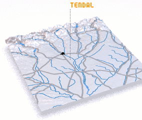 Places with similar names to Tendal, Spain ::
Disclaimer :: Information on this page comes without warranty of any kind |
||
|
Where is Tendal? Elevation and coordinates ::
Latitude (lat): 42°36'0"N Longitude (lon): 5°30'0"W
Elevation (approx.): 880m (map arrows pan, magnifying glasses zoom) |
||
|
Visiting Tendal? Hotel/Accommodation ::
Book a hotel in Tendal Travel Guide ::
Buy a travel guide for Spain rental cars ::
car rental offers GPS waypoint ::
download a GPX waypoint (PoI) of Tendal for your GPS receiver
|
||