|
search place name
|
||
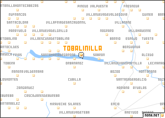
Tobalinilla (Castilla y León, Spain)Tobalinilla is a town in the Castilla y León region of Spain. An overview map of the region around Tobalinilla is displayed below.
regional and 3d topo map of Tobalinilla, Spain ::
Tobalinilla airports ::
The nearest airport is VIT - Vitoria, located 37.1 km east of Tobalinilla.
Other airports nearby include BIO - Bilbao (62.5 km north), SDR - Santander (91.4 km north west), PNA - Pamplona (123.1 km east), EAS - San Sebastian (128.7 km north east), Nearby towns ::
San Martín de Don (1.4km west) //
Orbañanoz (2.3km south west) //
Sobrón (2.7km east) //
Plágaro (4.6km north west) //
Santa María de Garoña (4.1km west) //
Mijaralengua (4.5km north west) //
Cubilla (5.7km south) //
Pajares (5.5km north west) //
Garoña (5.4km west) //
Barcina del Barco (5.7km west) //
Nograro (6.9km north east) //
Villafría de San Zadornil (7.9km north) //
Barrio (6.6km north east) //
Villaescusa de Tobalina (6.6km north west) //
Bozoo (6.6km south east) //
Herrán (7.8km north west) //
Villanueva del Grillo (7.8km north west) //
[all distances 'as the bird flies' and approximate] 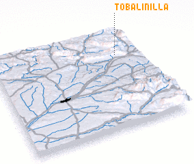 Places with similar names to Tobalinilla, Spain ::
// Tablonal (US)
Disclaimer :: Information on this page comes without warranty of any kind |
||
|
Where is Tobalinilla? Elevation and coordinates ::
Latitude (lat): 42°46'0"N Longitude (lon): 3°9'0"W
Elevation (approx.): 784m (map arrows pan, magnifying glasses zoom) |
||
|
Visiting Tobalinilla? Hotel/Accommodation ::
Book a hotel in Tobalinilla Travel Guide ::
Buy a travel guide for Spain rental cars ::
car rental offers GPS waypoint ::
download a GPX waypoint (PoI) of Tobalinilla for your GPS receiver
|
||