|
search place name
|
||
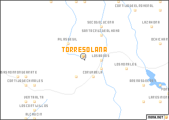
Torresolana (Andalucía, Spain)Torresolana is a town in the Andalucía region of Spain. An overview map of the region around Torresolana is displayed below.
regional and 3d topo map of Torresolana, Spain ::
Torresolana airports ::
The nearest airport is GRX - Granada, located 28.6 km north east of Torresolana.
Other airports nearby include GRX - Granada Armilla (36.3 km east), AGP - Malaga (57.4 km south west), ODB - Cordoba (117.5 km north west), OZP - Sevilla Moron Ab (143.3 km west), Nearby towns ::
Los Baños (3.0km east) //
Jurtiga (4.0km south) //
Alhama de Granada (3.5km south east) //
Corumbela (4.0km south) //
Pilas Dedil (4.7km north west) //
Santa Cruz de Alhama (6.3km north east) //
Seco de Lucena (8.0km north) //
[all distances 'as the bird flies' and approximate] 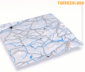 Places with similar names to Torresolana, Spain ::
// Dreisielen (DE)
// Dürselen (DE)
// Turów Celiny (PL)
// Terzialanı (TR)
// Dayr Salūnah (SY)
// Douar Ouizilene (MA)
// Treslon (FR)
// Dawwār Raʼs al ‘Ayn (TN)
// Dryslwyn (GB)
// Dar Salane (DZ)
Disclaimer :: Information on this page comes without warranty of any kind |
||
|
Where is Torresolana? Elevation and coordinates ::
Latitude (lat): 37°1'0"N Longitude (lon): 4°1'0"W
Elevation (approx.): 942m (map arrows pan, magnifying glasses zoom) |
||
|
Visiting Torresolana? Hotel/Accommodation ::
Book a hotel in Torresolana Travel Guide ::
Buy a travel guide for Spain rental cars ::
car rental offers GPS waypoint ::
download a GPX waypoint (PoI) of Torresolana for your GPS receiver
|
||