|
search place name
|
||
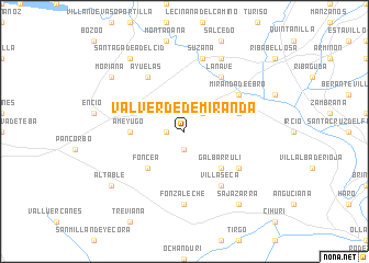
Valverde de Miranda (Castilla y León, Spain)Valverde de Miranda is a town in the Castilla y León region of Spain. An overview map of the region around Valverde de Miranda is displayed below.
regional and 3d topo map of Valverde de Miranda, Spain ::
Valverde de Miranda airports ::
The nearest airport is VIT - Vitoria, located 34.3 km north east of Valverde de Miranda.
Other airports nearby include BIO - Bilbao (72.7 km north), SDR - Santander (109.2 km north west), PNA - Pamplona (111.7 km east), EAS - San Sebastian (126.0 km north east), Nearby towns ::
Bugedo (1.4km west) //
Cellorigo (1.9km south) //
Orón (2.3km north east) //
Foncea (4.6km south west) //
Galbárruli (4.6km south east) //
Ameyugo (4.1km west) //
Bardauri (4.5km north east) //
Castilseco (5.5km south east) //
Villaseca (6.2km south east) //
Miranda de Ebro (5.5km north east) //
La Nave (6.2km north east) //
Ayuelas (6.2km north west) //
Fonzaleche (7.4km south) //
Suzana (7.5km north) //
Comunión (7.9km north) //
Altable (7.8km south west) //
Santa Gadea del Cid (8.5km north west) //
Sajazarra (8.5km south east) //
Moriana (7.8km north west) //
[all distances 'as the bird flies' and approximate]  Places with similar names to Valverde de Miranda, Spain :: Disclaimer :: Information on this page comes without warranty of any kind |
||
|
Where is Valverde de Miranda? Elevation and coordinates ::
Latitude (lat): 42°39'0"N Longitude (lon): 3°0'0"W
Elevation (approx.): 526m (map arrows pan, magnifying glasses zoom) |
||
|
Visiting Valverde de Miranda? Hotel/Accommodation ::
Book a hotel in Valverde de Miranda Travel Guide ::
Buy a travel guide for Spain rental cars ::
car rental offers GPS waypoint ::
download a GPX waypoint (PoI) of Valverde de Miranda for your GPS receiver
|
||