|
search place name
|
||
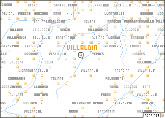
Villaldín (Asturias, Spain)Villaldín is a town in the Asturias region of Spain. An overview map of the region around Villaldín is displayed below.
regional and 3d topo map of Villaldín, Spain ::
Villaldín airports ::
The nearest airport is OVD - Aviles Asturias, located 32.1 km north of Villaldín.
Other airports nearby include BGC - Braganca (165.2 km south), VLL - Valladolid (204.4 km south east), Nearby towns ::
Momalo (1.3km west) //
Tejedo (2.3km north east) //
San Miguel (2.3km north east) //
Bárzana (2.3km south west) //
Santianes de Molenes (2.3km north west) //
Yernes (2.7km east) //
Ambás (3.7km north) //
Robledo (3.7km north) //
La Vega (2.7km west) //
Villabre (3.9km south) //
Villarruiz (3.9km south) //
Villamarín (3.9km south) //
Cubía (3.9km north) //
Villandás (3.3km north west) //
Rubiano (4.6km north east) //
Santa María (4.6km north west) //
Sorribas (5.6km north) //
El Lobio (5.6km north) //
Restiello (4.0km west) //
La Fueja (5.7km north) //
Vigaña (4.5km north west) //
Villagarcía (6.2km north east) //
Seaza (6.2km north west) //
La Cabaña (5.5km north west) //
Los Lodos (5.5km north west) //
Las Murias (5.5km north east) //
Panicera (5.5km north east) //
Noceda (6.2km south west) //
Las Villas (6.2km south west) //
[all distances 'as the bird flies' and approximate]  Places with similar names to Villaldín, Spain ::
// Valea lui Dan (RO)
// Villa Latina (IT)
Disclaimer :: Information on this page comes without warranty of any kind |
||
|
Where is Villaldín? Elevation and coordinates ::
Latitude (lat): 43°17'0"N Longitude (lon): 6°8'0"W
Elevation (approx.): 287m (map arrows pan, magnifying glasses zoom) |
||
|
Visiting Villaldín? Hotel/Accommodation ::
Book a hotel in Villaldín Travel Guide ::
Buy a travel guide for Spain rental cars ::
car rental offers GPS waypoint ::
download a GPX waypoint (PoI) of Villaldín for your GPS receiver
|
||