|
search place name
|
||
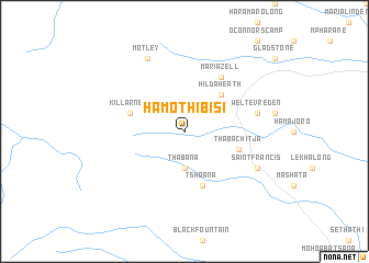
Ha-Mothibisi (South Africa)Ha-Mothibisi is a town in South Africa. An overview map of the region around Ha-Mothibisi is displayed below.
regional and 3d topo map of Ha-Mothibisi, South Africa ::
Ha-Mothibisi airports ::
The nearest airport is MSU - Maseru Moshoeshoe I Intl, located 124.0 km north west of Ha-Mothibisi.
Other airports nearby include UTT - Umtata Mthatha (136.7 km south), UTW - Queenstown (222.4 km south west), LAY - Ladysmith (239.4 km north east), Nearby towns ::
Thabana (3.7km south) //
Hilda Heath (4.9km north east) //
Tshoana (5.8km south) //
Ha-Sefoko (5.8km south) //
Thaba Chitja (5.1km east) //
Killarney (5.1km west) //
Mariazell (6.4km north east) //
Weltevreden (6.7km east) //
Saint Francis (7.4km south east) //
Mapolesene (7.4km south east) //
Motley (8.1km north west) //
[all distances 'as the bird flies' and approximate] 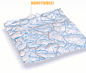 Places with similar names to Ha-Mothibisi, South Africa :: Disclaimer :: Information on this page comes without warranty of any kind |
||
|
Where is Ha-Mothibisi? Elevation and coordinates ::
Latitude (lat): 30°21'0"S Longitude (lon): 28°20'0"E
Elevation (approx.): 1829m (map arrows pan, magnifying glasses zoom) |
||
|
Visiting Ha-Mothibisi? Hotel/Accommodation ::
Book a hotel in Ha-Mothibisi Travel Guide ::
rental cars ::
car rental offers GPS waypoint ::
download a GPX waypoint (PoI) of Ha-Mothibisi for your GPS receiver
|
||