|
search place name
|
||
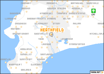
Heathfield (South Africa)Heathfield is a town in South Africa. An overview map of the region around Heathfield is displayed below.
regional and 3d topo map of Heathfield, South Africa ::
Heathfield airports ::
The nearest airport is CPT - Cape Town Intl, located 15.6 km north east of Heathfield.
Nearby towns ::
Grassy Park (1.5km east) //
Dieprivier (1.9km north) //
Steenberg (1.9km south) //
Bergvliet (1.5km west) //
Square Hill (1.9km south) //
Southfield (2.4km north east) //
Cafda Village (2.4km south east) //
Lavender Hill (2.4km south east) //
Meadowridge (2.4km north west) //
Plumstead (3.7km north) //
Sweet Valley (3.1km west) //
Ottery (4.0km north east) //
Marina da Gama (4.0km south) //
Parkwood (3.6km north east) //
Alphen (4.0km north west) //
Constantia (4.0km north west) //
Doordrift (4.0km north west) //
Raapkraal (4.0km south) //
Lakeside (4.0km south) //
Tokai (3.6km south west) //
Silverhurst (4.8km north west) //
Westlake (4.8km south west) //
Wynberg (5.6km north) //
Lotus River (5.0km east) //
Klein Steenberg (5.9km south west) //
Claremont (7.4km north) //
Muizenberg (7.4km south) //
Neptuneʼs Corner (7.4km south) //
Baileyʼs Cottage (7.4km south) //
[all distances 'as the bird flies' and approximate] 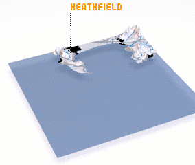 Places with similar names to Heathfield, South Africa ::
// Heathfield (JM)
// Heathfield (JM)
// Heathfield (AU)
// Heathfield (AU)
// Heathfield (GB)
// Hothfield (GB)
Disclaimer :: Information on this page comes without warranty of any kind |
||
|
Where is Heathfield? Elevation and coordinates ::
Latitude (lat): 34°3'0"S Longitude (lon): 18°28'0"E
Elevation (approx.): 13m (map arrows pan, magnifying glasses zoom) |
||
|
Visiting Heathfield? Hotel/Accommodation ::
Book a hotel in Heathfield Travel Guide ::
rental cars ::
car rental offers GPS waypoint ::
download a GPX waypoint (PoI) of Heathfield for your GPS receiver
|
||