|
search place name
|
||
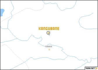
Ka-Ngubane (South Africa)Ka-Ngubane is a town in South Africa. An overview map of the region around Ka-Ngubane is displayed below.
regional and 3d topo map of Ka-Ngubane, South Africa ::
Ka-Ngubane airports ::
The nearest airport is MTS - Manzini Matsapha, located 83.2 km south east of Ka-Ngubane.
Other airports nearby include SZK - Skukuza (133.8 km north east), HDS - Hoedspruit Afb (175.1 km north), MPM - Maputo (177.6 km east), NCS - Newcastle (219.4 km south), Nearby towns ::
Tshaka (5.6km south) //
[all distances 'as the bird flies' and approximate]  Places with similar names to Ka-Ngubane, South Africa ::
// Cangbinoy (PH)
// Cangbinoy (PH)
// Kangabin (PH)
// Kinagbaan (PH)
// Kinagbaan (PH)
// Cuencabuena (ES)
// Gonga Bainu (ET)
// Kuanakabun (TP)
// Kungabnia (GH)
// Gang Boni (NG)
Disclaimer :: Information on this page comes without warranty of any kind |
||
|
Where is Ka-Ngubane? Elevation and coordinates ::
Latitude (lat): 25°56'0"S Longitude (lon): 30°48'0"E
Elevation (approx.): 972m (map arrows pan, magnifying glasses zoom) |
||
|
Visiting Ka-Ngubane? Hotel/Accommodation ::
Book a hotel in Ka-Ngubane Travel Guide ::
rental cars ::
car rental offers GPS waypoint ::
download a GPX waypoint (PoI) of Ka-Ngubane for your GPS receiver
|
||