|
search place name
|
||
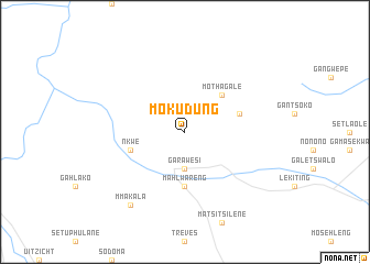
Mokudung (South Africa)Mokudung is a town in South Africa. An overview map of the region around Mokudung is displayed below.
regional and 3d topo map of Mokudung, South Africa ::
Mokudung airports ::
The nearest airport is PTG - Pietersburg, located 92.1 km south east of Mokudung.
Other airports nearby include LTA - Tzaneen (163.5 km east), PKW - Selebi-phikwe Selebi Phikwe (177.4 km north west), NTY - Pilanesberg Intl (271.9 km south west), Nearby towns ::
Ga-Rawesi (3.7km south) //
Mothagale (5.0km north east) //
Mahlwareng (5.6km south) //
Kgokonyane (5.4km east) //
Nkwe (5.4km west) //
Mmakala (9.0km south west) //
[all distances 'as the bird flies' and approximate] 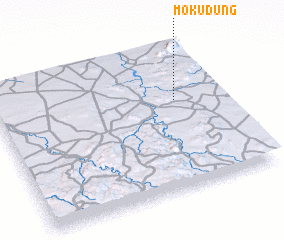 Places with similar names to Mokudung, South Africa ::
// Makawtaung (MM)
// Mauktaung (MM)
// Mawk-tawng (MM)
// Mi Gahtawng (MM)
// Mu-gahtawng (MM)
// Mugahtawng (MM)
// Mactang (PH)
// Mactang (PH)
// Magading (PH)
// Magduñgao (PH)
Disclaimer :: Information on this page comes without warranty of any kind |
||
|
Where is Mokudung? Elevation and coordinates ::
Latitude (lat): 23°23'0"S Longitude (lon): 28°48'0"E
Elevation (approx.): 959m (map arrows pan, magnifying glasses zoom) |
||
|
Visiting Mokudung? Hotel/Accommodation ::
Book a hotel in Mokudung Travel Guide ::
rental cars ::
car rental offers GPS waypoint ::
download a GPX waypoint (PoI) of Mokudung for your GPS receiver
|
||