|
search place name
|
||
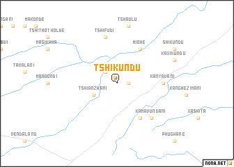
Tshikundu (South Africa)Tshikundu is a town in South Africa. An overview map of the region around Tshikundu is displayed below.
regional and 3d topo map of Tshikundu, South Africa ::
Tshikundu airports ::
The nearest airport is LTA - Tzaneen, located 111.5 km south of Tshikundu.
Other airports nearby include PHW - Phalaborwa (125.0 km south), HDS - Hoedspruit Afb (168.0 km south), PTG - Pietersburg (170.9 km south west), BFO - Chiredzi Buffalo Range (225.9 km north east), Nearby towns ::
Tshikonelo (1.7km east) //
Ha-Matsika (2.5km north west) //
Tshianzwani (3.9km south west) //
Miohe (6.5km north east) //
Ka-Madonsi (6.5km south east) //
Ka-Nyavani (6.8km east) //
Tshifudi (7.6km north) //
Ka-Mavundani (7.6km south east) //
[all distances 'as the bird flies' and approximate] 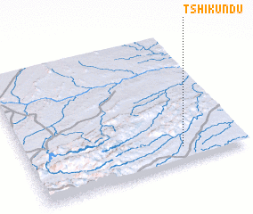 Places with similar names to Tshikundu, South Africa ::
// Tshakindo (CD)
// Tshikanda (CD)
// Tshikenda (CD)
// Tshikondo (CD)
// Tshikunda (CD)
// Tshikunda (CD)
// Tchikoundou (CG)
// Tashkent (UZ)
// Tchougoundi (NE)
// Toshkent (UZ)
Disclaimer :: Information on this page comes without warranty of any kind |
||
|
Where is Tshikundu? Elevation and coordinates ::
Latitude (lat): 22°53'0"S Longitude (lon): 30°43'0"E
Elevation (approx.): 523m (map arrows pan, magnifying glasses zoom) |
||
|
Visiting Tshikundu? Hotel/Accommodation ::
Book a hotel in Tshikundu Travel Guide ::
rental cars ::
car rental offers GPS waypoint ::
download a GPX waypoint (PoI) of Tshikundu for your GPS receiver
|
||