|
search place name
|
||
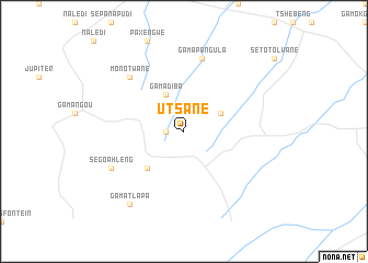
Utsane (South Africa)Utsane is a town in South Africa. An overview map of the region around Utsane is displayed below.
regional and 3d topo map of Utsane, South Africa ::
Utsane airports ::
The nearest airport is PTG - Pietersburg, located 32.4 km east of Utsane.
Other airports nearby include LTA - Tzaneen (118.9 km east), HDS - Hoedspruit Afb (197.7 km east), PHW - Phalaborwa (202.5 km east), PRY - Pretoria Wonderboom (214.7 km south west), Nearby towns ::
Machichaanʼs Location (1.7km west) //
Manyapje (3.9km north east) //
Ga-Madiba (4.1km north west) //
Mashashane (5.0km south west) //
Ga-Mapangula (7.6km north) //
Monotwane (7.5km north west) //
Segoahleng (7.7km south west) //
Ga-Matlapa (9.0km south west) //
[all distances 'as the bird flies' and approximate] 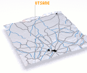 Places with similar names to Utsane, South Africa ::
Disclaimer :: Information on this page comes without warranty of any kind |
||
|
Where is Utsane? Elevation and coordinates ::
Latitude (lat): 23°55'0"S Longitude (lon): 29°10'0"E
Elevation (approx.): 1425m (map arrows pan, magnifying glasses zoom) |
||
|
Visiting Utsane? Hotel/Accommodation ::
Book a hotel in Utsane Travel Guide ::
rental cars ::
car rental offers GPS waypoint ::
download a GPX waypoint (PoI) of Utsane for your GPS receiver
|
||