|
search place name
|
||
Zihlahleni (South Africa)Zihlahleni is a town in South Africa. An overview map of the region around Zihlahleni is displayed below.
regional and 3d topo map of Zihlahleni, South Africa ::

Zihlahleni airports ::
The nearest airport is VIY - Bisho Bhisho, located 10.4 km south east of Zihlahleni.
Other airports nearby include ELS - East London (63.5 km east), UTW - Queenstown (106.9 km north), PLZ - Port Elizabeth Intl (192.5 km south west), UTT - Umtata Mthatha (201.5 km north east), Nearby towns ::
Msulugwa (1.6km east) //
Maipase (3.1km east) //
Debe Nek (4.8km north west) //
Dimbaza (5.0km east) //
Xukwane (6.4km south west) //
Mamata (6.2km east) //
Xengxe (7.6km south) //
Mama (7.2km south west) //
Bulembu (7.2km south east) //
Mngoesha (7.2km north east) //
Pirie (8.0km north east) //
Old Green River (8.8km south east) //
Ntsikizini (8.8km south east) //
[all distances 'as the bird flies' and approximate] 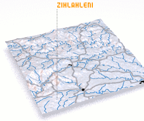 Places with similar names to Zihlahleni, South Africa ::
// Sihlahleni (ZA)
// Cililin (ID)
// Salolina (ID)
// Silaloni (KE)
// Selūlān (IR)
// Sol y Luna (VE)
// Sululuni (BO)
Disclaimer :: Information on this page comes without warranty of any kind |
||
|
Where is Zihlahleni? Elevation and coordinates ::
Latitude (lat): 32°51'0"S Longitude (lon): 27°11'0"E
Elevation (approx.): 607m (map arrows pan, magnifying glasses zoom) |
||
|
Visiting Zihlahleni? Hotel/Accommodation ::
Book a hotel in Zihlahleni Travel Guide ::
rental cars ::
car rental offers GPS waypoint ::
download a GPX waypoint (PoI) of Zihlahleni for your GPS receiver
|
||