|
search place name
|
||
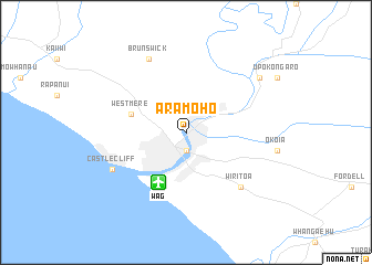
Aramoho (Akaroa, New Zealand)Aramoho is a town in the Akaroa region of New Zealand. An overview map of the region around Aramoho is displayed below.
regional and 3d topo map of Aramoho, New Zealand ::
Aramoho airports ::
The nearest airport is WAG - Wanganui, located 5.5 km south west of Aramoho.
Other airports nearby include PMR - Palmerston North (65.9 km south east), PPQ - Paraparaumu (109.8 km south), NPL - New Plymouth (125.6 km north west), MRO - Masterton (127.4 km south east), Nearby towns ::
Wanganui (1.9km south) //
Westmere (4.7km north west) //
Wiritoa (7.0km south east) //
Brunswick (7.9km north) //
Castlecliff (6.8km south west) //
Makirikiri (8.0km north east) //
[all distances 'as the bird flies' and approximate] 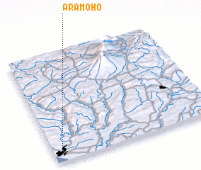 Places with similar names to Aramoho, New Zealand :: Disclaimer :: Information on this page comes without warranty of any kind |
||
|
Where is Aramoho? Elevation and coordinates ::
Latitude (lat): 39°55'0"S Longitude (lon): 175°3'0"E
Elevation (approx.): 5m (map arrows pan, magnifying glasses zoom) |
||
|
Visiting Aramoho? Hotel/Accommodation ::
Book a hotel in Aramoho Travel Guide ::
Buy a travel guide for New Zealand rental cars ::
car rental offers GPS waypoint ::
download a GPX waypoint (PoI) of Aramoho for your GPS receiver
|
||