|
search place name
|
||
Pakowhai (Akaroa, New Zealand)Pakowhai is a town in the Akaroa region of New Zealand. An overview map of the region around Pakowhai is displayed below.
regional and 3d topo map of Pakowhai, New Zealand ::

Pakowhai airports ::
The nearest airport is TUO - Taupo, located 115.5 km north west of Pakowhai.
Other airports nearby include PMR - Palmerston North (134.6 km south west), GIS - Gisborne (140.3 km north east), WAG - Wanganui (163.3 km west), ROT - Rotorua (170.5 km north), Nearby towns ::
Whakatu (2.3km south east) //
Awatoto (4.7km north east) //
Meeanee (4.7km north east) //
Greenmeadows (5.6km north) //
Tomoana (5.6km south) //
Clive (4.3km east) //
Waiohiki (4.7km north west) //
Taradale (5.7km north) //
Puk-kura (6.9km north) //
Hastings (7.9km south) //
Mast (7.1km north east) //
Puketapu (9.4km north west) //
[all distances 'as the bird flies' and approximate] 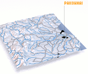 Places with similar names to Pakowhai, New Zealand ::
Disclaimer :: Information on this page comes without warranty of any kind |
||
|
Where is Pakowhai? Elevation and coordinates ::
Latitude (lat): 39°35'0"S Longitude (lon): 176°52'0"E
Elevation (approx.): 9m (map arrows pan, magnifying glasses zoom) |
||
|
Visiting Pakowhai? Hotel/Accommodation ::
Book a hotel in Pakowhai Travel Guide ::
Buy a travel guide for New Zealand rental cars ::
car rental offers GPS waypoint ::
download a GPX waypoint (PoI) of Pakowhai for your GPS receiver
|
||