|
search place name
|
||
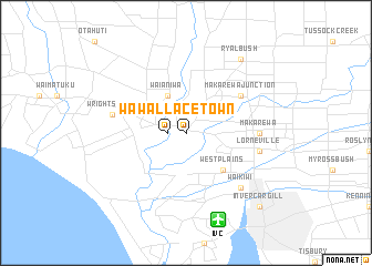
Wallacetown (Akaroa, New Zealand)Wallacetown is a town in the Akaroa region of New Zealand. An overview map of the region around Wallacetown is displayed below.
regional and 3d topo map of Wallacetown, New Zealand ::
Wallacetown airports ::
The nearest airport is IVC - Invercargill, located 9.1 km south of Wallacetown.
Other airports nearby include TEU - Manapouri (101.6 km north west), ZQN - Queenstown International Queenstown (150.1 km north), ALR - Alexandra (150.8 km north east), DUD - Dunedin (154.7 km east), Nearby towns ::
Wallacetown (1.3km west) //
Waianiwa (3.9km north) //
West Plains (4.5km south east) //
Makarewa Junction (5.3km north east) //
Makarewa (5.1km east) //
Wrights Bush (5.4km west) //
Lorneville (5.4km east) //
Waikiwi (6.8km south east) //
Ryal Bush (8.3km north east) //
Invercargill (9.0km south east) //
[all distances 'as the bird flies' and approximate] 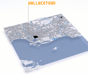 Places with similar names to Wallacetown, New Zealand ::
// Wallstown (US)
// Williston (US)
// Wallston (US)
// Wilsten (DE)
// Wöllstein (DE)
// Wollstein (DE)
// Williston (ZA)
// Wallacetown (NZ)
// Woolston (NZ)
// Wallaceton (US)
Disclaimer :: Information on this page comes without warranty of any kind |
||
|
Where is Wallacetown? Elevation and coordinates ::
Latitude (lat): 46°20'0"S Longitude (lon): 168°17'0"E
Elevation (approx.): 13m (map arrows pan, magnifying glasses zoom) |
||
|
Visiting Wallacetown? Hotel/Accommodation ::
Book a hotel in Wallacetown Travel Guide ::
Buy a travel guide for New Zealand rental cars ::
car rental offers GPS waypoint ::
download a GPX waypoint (PoI) of Wallacetown for your GPS receiver
|
||