|
search place name
|
||
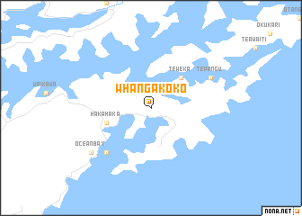
Whangakoko (Akaroa, New Zealand)Whangakoko is a town in the Akaroa region of New Zealand. An overview map of the region around Whangakoko is displayed below.
regional and 3d topo map of Whangakoko, New Zealand ::
Whangakoko airports ::
The nearest airport is BHE - Woodbourne, located 36.0 km south west of Whangakoko.
Other airports nearby include WLG - Wellington Intl (53.7 km east), NSN - Nelson (79.2 km west), PPQ - Paraparaumu (80.9 km north east), MRO - Masterton (127.9 km east), Nearby towns ::
 Places with similar names to Whangakoko, New Zealand ::
// Huongokiki (ID)
// Heng-k'o-k'ou (TW)
// Hoàng Các (VN)
// Hương Quế (2) (VN)
// Hongcaogou (CN)
// Huangquqiao (CN)
Disclaimer :: Information on this page comes without warranty of any kind |
||
|
Where is Whangakoko? Elevation and coordinates ::
Latitude (lat): 41°17'0"S Longitude (lon): 174°10'0"E
Elevation (approx.): 193m (map arrows pan, magnifying glasses zoom) |
||
|
Visiting Whangakoko? Hotel/Accommodation ::
Book a hotel in Whangakoko Travel Guide ::
Buy a travel guide for New Zealand rental cars ::
car rental offers GPS waypoint ::
download a GPX waypoint (PoI) of Whangakoko for your GPS receiver
|
||