|
search place name
|
||
Agabekhi (Chechnya, Russia)Agabekhi is a town in the Chechnya region of Russia. An overview map of the region around Agabekhi is displayed below.
regional and 3d topo map of Agabekhi, Russia ::

Agabekhi airports ::
The nearest airport is MCX - Makhachkala Uytash, located 141.9 km east of Agabekhi.
Nearby towns ::
Intsubatu (0.5km north) //
Anny (0.5km south) //
Bacharkhe (0.7km west) //
Gaydkhe (1.0km north west) //
Kenkhi (1.0km east) //
Shkolkhe (1.2km west) //
Yetmutkatly (1.5km south east) //
(( Kuankhi )) (1.3km south east) //
Bitsukhe (1.4km south east) //
Rakhulakhle (1.4km west) //
Gadiatly (1.6km west) //
Katatly (1.9km north west) //
Betkhume (1.9km east) //
Kabardatly (2.7km east) //
Anchilatli (3.4km east) //
Butti (4.0km north east) //
Khilidi (4.2km east) //
(( Anchil-Matso )) (6.4km south) //
[all distances 'as the bird flies' and approximate] 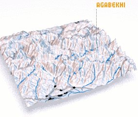 Places with similar names to Agabekhi, Russia :: Disclaimer :: Information on this page comes without warranty of any kind |
||
|
Where is Agabekhi? Elevation and coordinates ::
Latitude (lat): 42°38'25"N Longitude (lon): 45°56'12"E
Elevation (approx.): 1466m (map arrows pan, magnifying glasses zoom) |
||
|
Visiting Agabekhi? Hotel/Accommodation ::
Book a hotel in Agabekhi Travel Guide ::
Buy a travel guide for Russia rental cars ::
car rental offers GPS waypoint ::
download a GPX waypoint (PoI) of Agabekhi for your GPS receiver
|
||