|
search place name
|
||
Apraksino (Kostromskaya Oblast', Russia)Apraksino is a town in the Kostromskaya Oblast' region of Russia. An overview map of the region around Apraksino is displayed below.
regional and 3d topo map of Apraksino, Russia ::
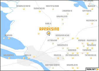
Nearby towns ::
Kitarikha (3.0km south) //
Guzdyrëvo (2.0km south east) //
Kholm (3.4km north) //
Lëgkovo (2.4km west) //
Derevnishche (2.9km east) //
Zhërnovka (5.2km north east) //
Sokerkino (5.5km south east) //
Shchetnikovo (5.5km south east) //
Shuvalovo (6.6km north east) //
Bol'shoye Bezgachevo (6.0km south east) //
Molodeyevo (4.8km east) //
Novaya (8.7km south) //
Maloye Bezgachëvo (7.6km south east) //
Vysokovo (8.9km south) //
Kostroma (8.6km south) //
Zhdanovo (9.0km north east) //
Shapovo (8.1km south east) //
Razliv (9.5km south west) //
Polevaya (9.5km south west) //
Malinovaya (9.5km south west) //
Petrovskoye (9.7km south east) //
[all distances 'as the bird flies' and approximate]  Places with similar names to Apraksino, Russia ::
// Apregación (ES)
// Apregación (ES)
// Apraksino (RU)
// Apraksino (RU)
// Apraksino (RU)
// Apraksino (RU)
// Apraksina (RU)
Disclaimer :: Information on this page comes without warranty of any kind |
||
|
Where is Apraksino? Elevation and coordinates ::
Latitude (lat): 57°50'35"N Longitude (lon): 40°59'17"E
Elevation (approx.): 110m (map arrows pan, magnifying glasses zoom) |
||
|
Visiting Apraksino? Hotel/Accommodation ::
Book a hotel in Apraksino Travel Guide ::
Buy a travel guide for Russia rental cars ::
car rental offers GPS waypoint ::
download a GPX waypoint (PoI) of Apraksino for your GPS receiver
|
||