|
search place name
|
||
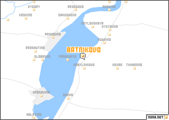
Batnikovo (Arkhangel'skaya Oblast', Russia)Batnikovo is a town in the Arkhangel'skaya Oblast' region of Russia. An overview map of the region around Batnikovo is displayed below.
regional and 3d topo map of Batnikovo, Russia ::
Nearby towns ::
Kobyl'nikovo (1.9km south) //
Aleksino (2.9km north) //
Yarokur'ye (1.8km west) //
Burmasovo (2.6km north east) //
Kudrino (4.4km north east) //
Kevar (4.0km south east) //
Krylovskaya (7.5km north) //
Votlozhma (6.2km north east) //
Privodino (6.0km north west) //
Vystavka (7.2km north) //
Gorka (8.8km south) //
[all distances 'as the bird flies' and approximate] 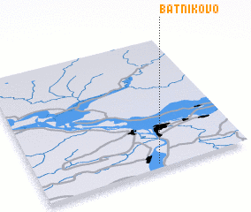 Places with similar names to Batnikovo, Russia ::
// Butenkov (RU)
// Batangafo (CF)
// Bodangafou (CF)
// Budnikovo (RU)
// Bet Neqofa (IL)
// Batengovo (BY)
Disclaimer :: Information on this page comes without warranty of any kind |
||
|
Where is Batnikovo? Elevation and coordinates ::
Latitude (lat): 61°2'0"N Longitude (lon): 46°34'0"E
(map arrows pan, magnifying glasses zoom) |
||
|
Visiting Batnikovo? Hotel/Accommodation ::
Book a hotel in Batnikovo Travel Guide ::
Buy a travel guide for Russia rental cars ::
car rental offers GPS waypoint ::
download a GPX waypoint (PoI) of Batnikovo for your GPS receiver
|
||