|
search place name
|
||
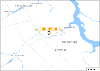
Boruksula (Rostovskaya Oblast', Russia)Boruksula is a town in the Rostovskaya Oblast' region of Russia. An overview map of the region around Boruksula is displayed below.
regional and 3d topo map of Boruksula, Russia ::
Boruksula airports ::
The nearest airport is ROV - Rostov Na Donu, located 134.3 km north west of Boruksula.
Other airports nearby include STW - Stavropol Shpakovskoye (189.9 km south), Nearby towns ::
Proletarsk (2.1km north east) //
Yagodnikova (2.6km west) //
Salenka (3.1km north west) //
Volovoy Baz (4.3km south east) //
Kermeshna (7.0km south east) //
Suprunovka (5.4km north east) //
Pervomayskaya (6.1km south east) //
[all distances 'as the bird flies' and approximate]  Places with similar names to Boruksula, Russia ::
// Brugghäusl (AT)
// Bergsoll (DE)
// Bërxull (AL)
// Burgazal (ES)
// Bariquizal (VE)
// Broxeele (FR)
// Barksal (VU)
// Bracksele (SE)
// Brigsley (GB)
// Barić Selo (HR)
Disclaimer :: Information on this page comes without warranty of any kind |
||
|
Where is Boruksula? Elevation and coordinates ::
Latitude (lat): 46°44'51"N Longitude (lon): 41°25'4"E
Elevation (approx.): 19m (map arrows pan, magnifying glasses zoom) |
||
|
Visiting Boruksula? Hotel/Accommodation ::
Book a hotel in Boruksula Travel Guide ::
Buy a travel guide for Russia rental cars ::
car rental offers GPS waypoint ::
download a GPX waypoint (PoI) of Boruksula for your GPS receiver
|
||