|
search place name
|
||
Bulatnikovo (Vladimirskaya Oblast', Russia)Bulatnikovo is a town in the Vladimirskaya Oblast' region of Russia. An overview map of the region around Bulatnikovo is displayed below.
regional and 3d topo map of Bulatnikovo, Russia ::

Nearby towns ::
Mordvinovo (1.9km south) //
Mezhishchi (2.8km north east) //
Shishlovo (5.6km north) //
Zaroslovo (5.6km south) //
Zimenki (3.6km south east) //
Fedorkova (3.6km north west) //
Morozovo (4.9km north east) //
Okulovo (7.5km south) //
Sel'tso (4.6km north east) //
Klimovo (7.5km north) //
Ivankova (6.4km north west) //
Afanasovo (5.6km south east) //
Poshatovo (5.6km south west) //
Katyshëvo (8.0km south east) //
Nikulino (7.0km south west) //
Bol'shoye Kol'tsovo (8.5km north west) //
[all distances 'as the bird flies' and approximate] 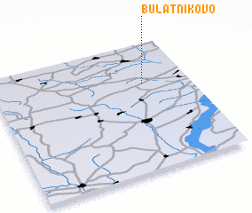 Places with similar names to Bulatnikovo, Russia ::
// Bolotnikovo (RU)
// Bolotnikovo (RU)
// Bolotnikovo (RU)
// Bolotnikovo (RU)
// Bolotnikovo (RU)
// Bulatnikovo (RU)
// Bulatnikovo (RU)
// Bulatnikovo (RU)
Disclaimer :: Information on this page comes without warranty of any kind |
||
|
Where is Bulatnikovo? Elevation and coordinates ::
Latitude (lat): 55°41'0"N Longitude (lon): 41°46'0"E
Elevation (approx.): 120m (map arrows pan, magnifying glasses zoom) |
||
|
Visiting Bulatnikovo? Hotel/Accommodation ::
Book a hotel in Bulatnikovo Travel Guide ::
Buy a travel guide for Russia rental cars ::
car rental offers GPS waypoint ::
download a GPX waypoint (PoI) of Bulatnikovo for your GPS receiver
|
||