|
search place name
|
||
Cheremoshny (Orlovskaya Oblast', Russia)Cheremoshny is a town in the Orlovskaya Oblast' region of Russia. An overview map of the region around Cheremoshny is displayed below.
regional and 3d topo map of Cheremoshny, Russia ::
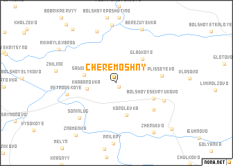
Nearby towns ::
Zolotukhino (0.7km south) //
Khabarovka (3.0km west) //
Sadovaya (3.3km west) //
Korolëvka (5.3km south) //
Gladkoye (4.6km north east) //
Bol'shoye Sevryukovo (4.3km south east) //
Maloye Sevryukovo (5.6km south east) //
Plisseyevo (4.6km east) //
Zhuravinka (5.4km south east) //
Petrovskoye (5.1km west) //
Sonin-Lug (6.7km south west) //
Alyab'yevo (8.5km north) //
Berezuyevka (9.0km north) //
Zherdëvo (8.8km south east) //
Stanovaya (8.8km south east) //
Znamenka (9.3km south west) //
Bobrik (9.6km north west) //
[all distances 'as the bird flies' and approximate] 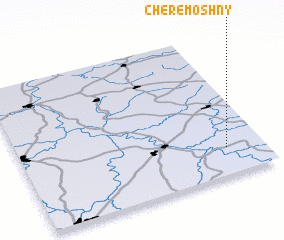 Places with similar names to Cheremoshny, Russia ::
// Cheremoshna (UA)
// Cheremoshno (UA)
// Cheremoshnoy (RU)
// Cheremshan (RU)
// Cheremshan (RU)
// Cheremshany (RU)
// Cheremshina (RU)
// Cherëmshino (RU)
// Chermoshny (RU)
// Cheremoshenʼ (UA)
Disclaimer :: Information on this page comes without warranty of any kind |
||
|
Where is Cheremoshny? Elevation and coordinates ::
Latitude (lat): 53°11'20"N Longitude (lon): 36°50'48"E
Elevation (approx.): 199m (map arrows pan, magnifying glasses zoom) |
||
|
Visiting Cheremoshny? Hotel/Accommodation ::
Book a hotel in Cheremoshny Travel Guide ::
Buy a travel guide for Russia rental cars ::
car rental offers GPS waypoint ::
download a GPX waypoint (PoI) of Cheremoshny for your GPS receiver
|
||