|
search place name
|
||
Dunil'tsovo (Ivanovskaya Oblast', Russia)Dunil'tsovo is a town in the Ivanovskaya Oblast' region of Russia. An overview map of the region around Dunil'tsovo is displayed below.
regional and 3d topo map of Dunil'tsovo, Russia ::
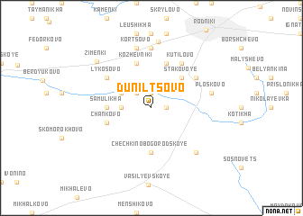
Nearby towns ::
Morozikha (1.0km east) //
Zimenki (1.9km north) //
Mamonikha (2.1km north west) //
Baranikha (2.0km west) //
Zelënovo (2.7km north west) //
Stakovoye (4.2km north east) //
Nadorozhnovo (3.0km west) //
Vysokovo (3.0km west) //
Samulikha (3.0km west) //
Chechkino-Bogorodskoye (5.6km south) //
Kozloki (5.7km north) //
Kozhevniki (5.7km north) //
Chankovo (3.5km south west) //
Lykosovo (4.8km north west) //
Porkhachëvo (4.8km north east) //
Kutilovo (5.9km north) //
Dereven'ki (7.4km north) //
Ploskovo (4.4km north east) //
Zhzhonikha (4.4km north east) //
Kortsovo (7.5km north) //
Nikitinskoye (6.3km south east) //
Boltino (8.3km north) //
Zimenki (6.8km north west) //
[all distances 'as the bird flies' and approximate] 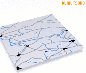 Places with similar names to Dunil'tsovo, Russia ::
Disclaimer :: Information on this page comes without warranty of any kind |
||
|
Where is Dunil'tsovo? Elevation and coordinates ::
Latitude (lat): 57°1'0"N Longitude (lon): 41°40'0"E
Elevation (approx.): 120m (map arrows pan, magnifying glasses zoom) |
||
|
Visiting Dunil'tsovo? Hotel/Accommodation ::
Book a hotel in Dunil'tsovo Travel Guide ::
Buy a travel guide for Russia rental cars ::
car rental offers GPS waypoint ::
download a GPX waypoint (PoI) of Dunil'tsovo for your GPS receiver
|
||