|
search place name
|
||
Kadyshi (Chuvashiya, Russia)Kadyshi is a town in the Chuvashiya region of Russia. An overview map of the region around Kadyshi is displayed below.
regional and 3d topo map of Kadyshi, Russia ::

Nearby towns ::
Vurmankasy (2.2km south) //
Vurmankasy (2.1km south east) //
Kyul'khiri (2.5km north east) //
Kalinino (4.7km north) //
Chalym-Kukshum (5.9km north) //
Machamushi (6.9km north) //
Chirish-Shinery (4.1km west) //
Burtasy (7.1km south) //
Shorkasy (4.9km north west) //
Sin'yaly (7.3km north) //
Sendimirkino (5.6km south east) //
Yambakhtino (6.4km north west) //
Bol'shoy Khirlep (7.7km north) //
Pitishevo (5.6km south west) //
Khumushi (8.3km north) //
Kumbali (8.5km north) //
Anatkas-Abyzovo (5.7km south east) //
Abyzovo (6.1km south east) //
Maldy-Kasy (8.1km north west) //
Kukshum (7.0km north east) //
Al'menevo (8.5km north east) //
[all distances 'as the bird flies' and approximate] 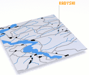 Places with similar names to Kadyshi, Russia ::
Disclaimer :: Information on this page comes without warranty of any kind |
||
|
Where is Kadyshi? Elevation and coordinates ::
Latitude (lat): 55°34'0"N Longitude (lon): 46°51'0"E
Elevation (approx.): 100m (map arrows pan, magnifying glasses zoom) |
||
|
Visiting Kadyshi? Hotel/Accommodation ::
Book a hotel in Kadyshi Travel Guide ::
Buy a travel guide for Russia rental cars ::
car rental offers GPS waypoint ::
download a GPX waypoint (PoI) of Kadyshi for your GPS receiver
|
||