|
search place name
|
||
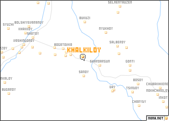
Khal-Kiloy (Chechnya, Russia)Khal-Kiloy is a town in the Chechnya region of Russia. An overview map of the region around Khal-Kiloy is displayed below.
regional and 3d topo map of Khal-Kiloy, Russia ::
Khal-Kiloy airports ::
The nearest airport is MCX - Makhachkala Uytash, located 152.1 km east of Khal-Kiloy.
Nearby towns ::
Marshen-Keli (2.7km north west) //
Musolt-Aul (2.6km north west) //
Sanoy (3.4km south) //
Sharo-Argun (2.7km south east) //
Benoy (3.2km west) //
Aslanbek-Sheripovo (3.5km north west) //
Bogatovka (4.3km north west) //
Dekhesty (5.0km west) //
Yukerch-Keloy (5.7km north west) //
Nyukhoy (7.1km north east) //
Bogacheroy (5.8km east) //
Sal'beroy (6.2km north east) //
Bukuzi (8.5km north) //
Day (8.1km south east) //
Day (8.1km south east) //
[all distances 'as the bird flies' and approximate]  Places with similar names to Khal-Kiloy, Russia ::
// Khulugli (RU)
// Khulugli (RU)
// Khālkula (BD)
// Khālkula (BD)
// Khālkula (BD)
// Kehelagala (LK)
// Khāleh Kūl (IR)
// Khālo Qala (PK)
// Khule Kili (PK)
// Kāhul Kili (PK)
Disclaimer :: Information on this page comes without warranty of any kind |
||
|
Where is Khal-Kiloy? Elevation and coordinates ::
Latitude (lat): 42°49'36"N Longitude (lon): 45°47'32"E
Elevation (approx.): 1034m (map arrows pan, magnifying glasses zoom) |
||
|
Visiting Khal-Kiloy? Hotel/Accommodation ::
Book a hotel in Khal-Kiloy Travel Guide ::
Buy a travel guide for Russia rental cars ::
car rental offers GPS waypoint ::
download a GPX waypoint (PoI) of Khal-Kiloy for your GPS receiver
|
||