|
search place name
|
||
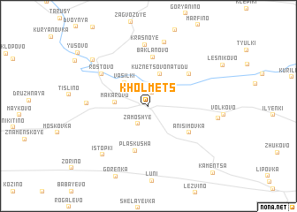
Kholmets (Tverskaya Oblast', Russia)Kholmets is a town in the Tverskaya Oblast' region of Russia. An overview map of the region around Kholmets is displayed below.
regional and 3d topo map of Kholmets, Russia ::
Nearby towns ::
Sozonovo (1.7km north) //
Zamosh'ye (2.4km south) //
Vasil'ki (3.4km north west) //
Kuznetsovo na Tudu (4.1km north) //
Makarovo (2.4km west) //
Plaskusha (5.7km south) //
Anisimovka (4.4km south east) //
Baklanovo (6.2km north) //
Bezobrazovo (5.0km north east) //
Rostovo (5.2km north west) //
Krasnoye (7.8km north) //
Krestovaya (4.3km west) //
Tishnevo (8.2km north) //
Istopki (6.9km south west) //
Rasskazovo (5.1km east) //
Kozhukhovo (7.0km north west) //
Kamentsa (9.6km south east) //
[all distances 'as the bird flies' and approximate]  Places with similar names to Kholmets, Russia ::
Disclaimer :: Information on this page comes without warranty of any kind |
||
|
Where is Kholmets? Elevation and coordinates ::
Latitude (lat): 56°20'49"N Longitude (lon): 33°21'13"E
Elevation (approx.): 253m (map arrows pan, magnifying glasses zoom) |
||
|
Visiting Kholmets? Hotel/Accommodation ::
Book a hotel in Kholmets Travel Guide ::
Buy a travel guide for Russia rental cars ::
car rental offers GPS waypoint ::
download a GPX waypoint (PoI) of Kholmets for your GPS receiver
|
||