|
search place name
|
||
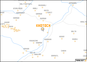
Khotoch (Dagestan, Russia)Khotoch is a town in the Dagestan region of Russia. An overview map of the region around Khotoch is displayed below.
regional and 3d topo map of Khotoch, Russia ::
Khotoch airports ::
The nearest airport is MCX - Makhachkala Uytash, located 73.4 km north east of Khotoch.
Nearby towns ::
Khindakh (1.4km south east) //
Murada (4.6km north) //
Kommuna (4.7km south) //
Khopor (6.2km south) //
Rugudzha (5.9km south west) //
Darada (6.7km north) //
Tunzy (7.3km north) //
Iputa (8.0km north) //
Keger (6.7km south east) //
Maali (9.3km north) //
Unkida (10.2km south west) //
[all distances 'as the bird flies' and approximate] 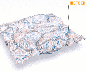 Places with similar names to Khotoch, Russia ::
// Kahatchee (US)
// Khatusha (RU)
// Khatusha (RU)
// Khotusha (RU)
// Khātāsia (BD)
// Cahuatache (MX)
// Khatcha (UZ)
// Khatcha (UZ)
// Khatcha (UZ)
// Kheydehchī (IR)
Disclaimer :: Information on this page comes without warranty of any kind |
||
|
Where is Khotoch? Elevation and coordinates ::
Latitude (lat): 42°24'21"N Longitude (lon): 46°57'8"E
Elevation (approx.): 1055m (map arrows pan, magnifying glasses zoom) |
||
|
Visiting Khotoch? Hotel/Accommodation ::
Book a hotel in Khotoch Travel Guide ::
Buy a travel guide for Russia rental cars ::
car rental offers GPS waypoint ::
download a GPX waypoint (PoI) of Khotoch for your GPS receiver
|
||