|
search place name
|
||
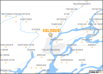
Kolmovo (Novgorodskaya Oblast', Russia)Kolmovo is a town in the Novgorodskaya Oblast' region of Russia. An overview map of the region around Kolmovo is displayed below.
regional and 3d topo map of Kolmovo, Russia ::
Kolmovo airports ::
The nearest airport is LED - St. Petersburg Pulkovo, located 149.3 km north west of Kolmovo.
Nearby towns ::
Derevyanitsy (1.0km east) //
Navolok (2.1km north east) //
Krechno (2.1km north east) //
Pogorelets (2.1km south east) //
Trubichino (3.8km north) //
Volkhovskiy (2.7km north east) //
Velikiy Novgorod (5.6km south) //
Syrkovo (3.4km north west) //
Motorovo (5.9km north) //
Arkazha (7.7km south) //
Spas-Nereditsy (7.7km south) //
Volotovo (5.4km south east) //
Leshino (6.8km south west) //
Vitka (8.0km north) //
[all distances 'as the bird flies' and approximate] 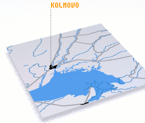 Places with similar names to Kolmovo, Russia ::
Disclaimer :: Information on this page comes without warranty of any kind |
||
|
Where is Kolmovo? Elevation and coordinates ::
Latitude (lat): 58°34'0"N Longitude (lon): 31°17'0"E
Elevation (approx.): 30m (map arrows pan, magnifying glasses zoom) |
||
|
Visiting Kolmovo? Hotel/Accommodation ::
Book a hotel in Kolmovo Travel Guide ::
Buy a travel guide for Russia rental cars ::
car rental offers GPS waypoint ::
download a GPX waypoint (PoI) of Kolmovo for your GPS receiver
|
||