|
search place name
|
||
Kostino (Orlovskaya Oblast', Russia)Kostino is a town in the Orlovskaya Oblast' region of Russia. An overview map of the region around Kostino is displayed below.
regional and 3d topo map of Kostino, Russia ::
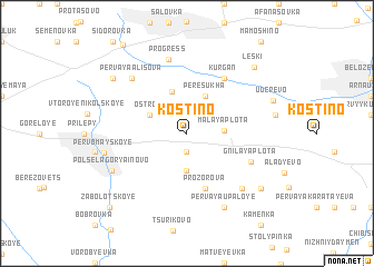
Nearby towns ::
Pervoye Yazyhkovo (1.9km south) //
Vtoroye Yazykovo (3.7km south) //
Malaya Plota (2.3km east) //
Peresukha (3.9km north) //
Ostrov (2.9km north west) //
Orlyanka (4.3km north) //
Prozorova (5.7km south) //
Kurgan (6.0km north) //
Gnilaya Plota (4.9km south east) //
Progress (7.5km north) //
Tret'ya Upaloye (6.5km south east) //
Pervaya Alisova (6.5km north west) //
Pervaya Upaloye (7.8km south) //
Polsela Goryainovo (5.9km south west) //
Pervomayskoye (5.4km west) //
Vtoraya Upaloye (7.2km south east) //
Fëdorovka (7.2km north west) //
Uderevo (6.3km north east) //
Leski (7.8km north east) //
Zabolotskoye (8.8km south west) //
[all distances 'as the bird flies' and approximate] 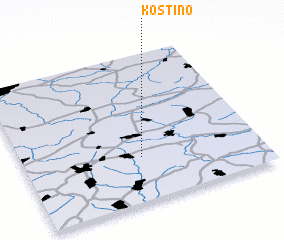 Places with similar names to Kostino, Russia ::
Disclaimer :: Information on this page comes without warranty of any kind |
||
|
Where is Kostino? Elevation and coordinates ::
Latitude (lat): 52°18'0"N Longitude (lon): 36°30'0"E
Elevation (approx.): 210m (map arrows pan, magnifying glasses zoom) |
||
|
Visiting Kostino? Hotel/Accommodation ::
Book a hotel in Kostino Travel Guide ::
Buy a travel guide for Russia rental cars ::
car rental offers GPS waypoint ::
download a GPX waypoint (PoI) of Kostino for your GPS receiver
|
||