|
search place name
|
||
Krugliki (Tul'skaya Oblast', Russia)Krugliki is a town in the Tul'skaya Oblast' region of Russia. An overview map of the region around Krugliki is displayed below.
regional and 3d topo map of Krugliki, Russia ::

Krugliki airports ::
The nearest airport is VOZ - Voronezh Chertovitskoye, located 156.3 km south east of Krugliki.
Nearby towns ::
Prozorovka (4.4km south) //
Platonovka (3.0km east) //
Pushkari (6.5km north) //
Inozemka (6.7km north) //
Semenëk (5.3km south west) //
Nikolayevka (8.1km south) //
Lotashok (5.3km south west) //
Tolstaya Dubrava (8.2km south) //
Strel'tsy (8.6km north) //
Gnilusha (8.3km south) //
Yegorovka (8.3km south) //
Lobanovo (5.4km east) //
Nikol'skoye (5.5km west) //
Bogovo (8.4km north west) //
Bolotovka (7.1km north east) //
[all distances 'as the bird flies' and approximate] 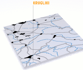 Places with similar names to Krugliki, Russia ::
// Kargalyk (AZ)
// Qarakolluq (AZ)
// Qarğalıg (AZ)
// Gryglaki (PL)
// Krogulec (PL)
// Krykulec (PL)
// Kirkliukai (LT)
// Karakullak (AL)
// Karacaoluk (TR)
// Karakolköy (TR)
Disclaimer :: Information on this page comes without warranty of any kind |
||
|
Where is Krugliki? Elevation and coordinates ::
Latitude (lat): 53°3'21"N Longitude (lon): 38°9'13"E
Elevation (approx.): 205m (map arrows pan, magnifying glasses zoom) |
||
|
Visiting Krugliki? Hotel/Accommodation ::
Book a hotel in Krugliki Travel Guide ::
Buy a travel guide for Russia rental cars ::
car rental offers GPS waypoint ::
download a GPX waypoint (PoI) of Krugliki for your GPS receiver
|
||