|
search place name
|
||
Krupnikovo (Novgorodskaya Oblast', Russia)Krupnikovo is a town in the Novgorodskaya Oblast' region of Russia. An overview map of the region around Krupnikovo is displayed below.
regional and 3d topo map of Krupnikovo, Russia ::
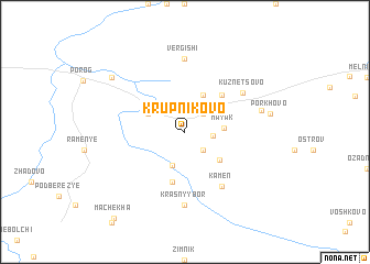
Nearby towns ::
Zarech'ye (2.1km north east) //
Gonyachevo (2.1km south east) //
Gory (1.5km east) //
Novaya Krapivna (3.5km south) //
Mayak (2.1km east) //
Vyshitino (2.7km north west) //
Vasil'kovo (3.8km north) //
Dregli (3.1km north east) //
Dymnitsa (3.4km south east) //
Zhukovo (4.2km north east) //
Staraya Krapivna (5.1km south) //
Krasnaya Gorka (5.9km south) //
Kamen' (5.9km south) //
Kuznetsovo (4.9km north east) //
Vergishi (7.4km north) //
Krasnyy Bor (7.4km south) //
Abros'yevo (4.6km north east) //
Porkhovo (4.8km east) //
Val'kovo (6.7km north west) //
Machekha (9.5km south west) //
[all distances 'as the bird flies' and approximate] 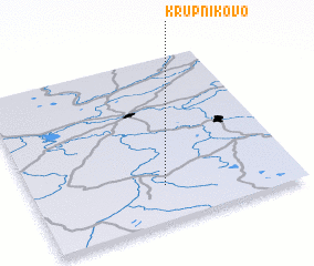 Places with similar names to Krupnikovo, Russia ::
// Karpenkovo (RU)
Disclaimer :: Information on this page comes without warranty of any kind |
||
|
Where is Krupnikovo? Elevation and coordinates ::
Latitude (lat): 59°13'0"N Longitude (lon): 33°30'0"E
Elevation (approx.): 130m (map arrows pan, magnifying glasses zoom) |
||
|
Visiting Krupnikovo? Hotel/Accommodation ::
Book a hotel in Krupnikovo Travel Guide ::
Buy a travel guide for Russia rental cars ::
car rental offers GPS waypoint ::
download a GPX waypoint (PoI) of Krupnikovo for your GPS receiver
|
||